- hot-spots
- forest fire
- USA
- California wildfires
Problems
The problem of wildfires in California
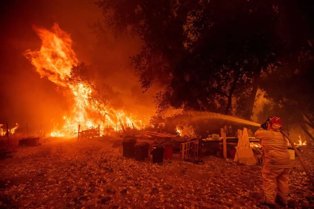
California has dry, windy, and often hot weather conditions from spring through late fall that can cause moderate to severe wildfires. The land area in California is 99,813,760, or approximately 100 million acres, and the area burned annually ranges from 90,000 acres, or 0.09%, to 1,590,000 acres, or 1.59% of the total California area. Forest fires in California are becoming increasingly dangerous because of the accumulation of wood fuels in the forests, population growth, and an increase in power lines and distribution. Sometimes these wildfires are swollen or exacerbated by strong dry winds known as Diablo winds in the northern part of the state, and Santa Ana winds in the south. Large fires can result in billions of dollars in losses.
Largest fires
The following is a list of the five largest wildfires in California. In California history, fires have burned more than 6.5 million acres - more than twice the size of Santa Clara, San Mateo, Alameda, Contra Costa, San Francisco, and Marin counties combined.

●  Augusta Complex. August Complex, a series of lightning-induced fires that broke out in August 2020, burning 1,032,648 acres of land in Mendocino, Humboldt, Trinity, Tehama, Glenn, Lake, and Colusa counties. It destroyed 935 structures and caused one death.

●  Dixie Fire. The active Dixie Fire began in July and burned 960,583 acres in Butte, Plumas, Lassen, and Tehama counties. 1,329 structures were destroyed and one person was killed. The cause is still being investigated.

●  Mendocino Complex. The Mendocino Complex, a series of fires that began in July 2018, burned 459,123 acres in Colusa, Lake, Mendocino, and Glenn counties. The complex destroyed 280 structures and caused one fatality. The ranch fire, which was the largest fire in the complex, was started by a Potter Valley rancher who drove a stake into the ground to try to plug a hornet's nest and caused a spark in the dry grass.

●  SCU Lightning Protection Complex. The SCU Lightning Complex, a series of lightning-induced fires in Stanislaus, Santa Clara, Alameda, Contra Costa, and San Joaquin counties, began in August 2020 and burned 396,624 acres. The fires destroyed 222 structures.

●  Creek Fire. The Creek Fire, which started in September 2020, burned 378,895 acres in Fresno and Madera counties. It destroyed 853 structures, and the cause has not been determined.
The fires have become the most destructive in recent years. Four of the five largest fires in California history have occurred since 2020.
Why the fires are happening
The conditions that set the stage for the staggering escalation of wildfires in California are multilayered and complex, but the climate emergency is the primary cause.

The climate crisis has intensified drought and heat, two factors that have always been natural elements of the western landscape, but play a crucial role in the emergence of larger fires.

As early as spring, when the landscape is usually still lush and green because of the winter rains, the region is showing signs of historic drought. The hillsides turn brown, bushes shrivel, and the dense layer of fall that is usually wet at this time, which collects and decomposes in the forest floor, quickly dries out. The landscape is prone to fire much earlier, increasing the risk that small pockets of fire quickly turn to hell.
Another factor is heat. Abnormally high temperatures help remove the last of the moisture from the environment. They have become a formidable precursor to thousands of fires, which quickly turn into high and high-temperature fires.

Drying out and heat-induced fires behave erratically, throwing sparks and embers for miles, traversing fire breaks, and crossing terrain once thought to be fire-free.

Firefighters have encountered conditions they have never encountered before, making fires harder to put out and, in some cases, nearly impossible to stop.
Gallery
16



Timelines
2026
September 22
Burning near Wawona, California, in Mariposa County, the active Dome Fire has consumed 3,420 acres since it started on September 15.
Satellites are picking up 41 heat detections over the past 48 hours, highlighting the extent of the spread for a blaze that has been burning for 7 days with an average daily growth of approximately 489 acres per day.
Managed by a Complex Incident Management Team as a Type 1 Incident, the fire is currently 15 percent contained and fueled by timber, litter, and understory on federal land overseen by the National Park Service.

Across the country, the broader fire year has seen 3,259,929 hectares burned so far in 2026, a figure that remains 41% below the two-decade average.
September 15
Burning near Wawona, California, in Mariposa County, the active Dome Fire started on September 15.
September 12
Burning through private land near Potter Valley in Lake County, California, the active Lucas Fire has scorched 1,099 acres since it started on September 10.
Across its two days of burning, the blaze has maintained an approximate average daily growth of 550 acres per day.

Satellites are actively monitoring the incident, with NASA FIRMS detecting 34 heat signatures in the area over the last 48 hours, illustrating the current spread of the fire front as it progresses through the region's typical fire season, which runs from June to October.
September 10
Burning through private land near Potter Valley in Lake County, California, the active Lucas Fire started on September 10.
September 04
Burning across the steep federal terrain of Monterey County, California, the active Plaskett Fire has scorched 29,702 acres since it began on August 26, 2026. Situated 34 miles southwest of Big Sur, the fire has maintained an average daily growth of approximately 3,300 acres over its nine days of burning. Driven by six-foot chaparral fuels, current fire behavior includes active uphill runs, flanking, and backing. Satellites are picking up a cluster of 10 heat detections near the perimeter over the past 48 hours, illustrating the ongoing spread of the front.

"The Plaskett Fire remains far more volatile, with continued growth reported across portions of the incident. Steep, rugged terrain, heavy vegetation, and limited access are all complicating suppression efforts," officials said.

This incident unfolded during the region's typical fire season, which runs from June to October. Nationally, the broader picture shows 3,172,718 hectares burned so far in 2026, marking a figure that is 42% below the two-decade average.
September 02
The larger Timber Fire is located southeast of Loma Vista in Monterey County, California, along the Big Sur coastline.
It is affecting the area around Pfeiffer Big Sur State Park, the Ventana Wilderness, and the Highway 1 corridor, with potential fire growth toward the Lucia Range, Lion Creek, and the Carmel River drainages.

As of September 2, the Timber Fire has burned approximately 25,223 acres and is 22% contained. Crews have made strong progress securing containment lines from Bottchers Gap and Kincannon Road to the Los Padres Dam and along Coast Ridge Road, and firing operations around Pfeiffer Big Sur State Park have been held successfully. However, more than 660 structures remain threatened, and the fire is expected to continue growing.
September 01
Spreading at an average daily clip of 4,456 acres, the active Plaskett Fire, burning 34 miles southwest of Big Sur, California, in Monterey County, has now consumed 26,734 acres over six days of activity.
Federal fire crews from the USFS Complex Incident Management Team are managing the blaze as it burns through short grass fuels on federal land, bringing total containment to 1 percent.

Satellites are picking up 61 heat signatures near the fire zone over the past 48 hours, illustrating the extent of the spread as the fire behavior produces moderate activity, flanking, uphill runs, and single tree torching.

This California fire burns against the backdrop of a broader national landscape, with 3,150,304 hectares burned so far in 2026, marking a figure that sits 43 percent below the two-decade average.
August 26
The Plaskett Fire, start of August 26, is location 34 Miles SW from Big Sur, California, in Monterey County.
Very poor air quality.
August 21
Firefighters continued their efforts to contain the Timber Fire burning in California's Big Sur, as the firefight is set to enter its third week.

According to Cal Fire, the fire has burned at least 6,147 acres as of the afternoon of August 21, with containment at 29%.

Officials said the cause of the Timber Fire remains under investigation.
August 14
California Governor Gavin Newsom is negotiating wildfire liability reforms with state lawmakers as the legislative session nears its end on August 31, 2026. Critics, including wildfire survivors and consumer advocates, accuse him of attempting to shift liability costs from utility companies to taxpayers and homeowners, which they label a "bailout." Newsom's office says the reforms aim to ensure reliable compensation for future fire victims, maintain affordable utility rates, and hold utility executives accountable. The proposed changes would not affect payouts for survivors of the Eaton fire, which began on January 7, 2025, but some survivors fear the reforms could be retroactively applied. The California Wildfire Fund, which currently holds $22 billion, risks depletion without these reforms, potentially leaving future victims without compensation. As negotiations continue, advocates are demanding transparency and immediate access to the proposed legislation.
August 14
A fast-moving brush fire, named the Taffle Fire, broke out in Riverside County on August 14, 2026, shortly after 12:30 p.m., burning 55 acres and currently 25% contained. Evacuation orders were issued for zones RVC-1912 and RVC-1979, while evacuation warnings were placed for residences and ranches east of Oak, north of Taffle Ranch, and south of Red Mountain. A care and reception center was established at Hemet High School for evacuees. Firefighters from CAL FIRE and the Riverside County Fire Department are actively battling the blaze, with no reported injuries or property damage. Investigators are investigating the cause, and firefighters are working to contain it through the night.
August 13
Multiple wildfires are actively burning across California as of August 13, 2026, with significant acreage affected and low containment levels reported. The Timber Fire in Big Sur has burned 4,245 acres and is only 7% contained, with evacuation orders in place for several zones and 503 structures threatened.
The Bug Fire, which started in Lassen County, has spread to 88,442 acres and is 15% contained, prompting evacuation orders in Lassen and Plumas counties, as well as Washoe County, Nevada. In Humboldt County, the MP18 Fire has consumed 3,937 acres and is 6% contained, with evacuation orders issued for specific zones. The Plains Fire in San Luis Obispo County has burned approximately 2,500 acres and is 35% contained, with no evacuation orders currently in effect. No injuries have been reported across these fires, and investigators are looking into the causes.
August 11
A fast-growing wildfire ignited in Big Sur, burning 2,000 acres and spurring evacuation orders that encompass some of the area’s iconic destinations such as Nepenthe restaurant, the Henry Miller Memorial Library and the Alila Ventana resort.

The fire began in the Los Padres National Forest southeast of the neighborhood of Loma Vista and quickly scorched 400 acres, according to the California Department of Forestry and Fire Protection.
The fire is burning on the east side of the highway, the Forest Service said.
August 08
The fire in Big Sur was first reported on the night of August 8 in the Los Padres National Forest, southeast of Loma Vista.
August
Investigators concluded that the Eaton Fire was electrical in origin and was ignited by material falling from a Southern California Edison transmission tower after two electrical arcing events were captured on video. Southern California Edison had previously acknowledged its likely involvement and established a compensation fund for victims in October 2025, committing hundreds of millions of dollars.
July 14
A massive wildfire burning in California’s Sierra Nevada has quickly become one of the largest in California this year.

The Elephant Fire in Sierra County has scorched more than 12,300 acres since it was reported on July 11, north of Loyalton in the Tahoe National Forest, according to CAL FIRE.

More than 500 firefighters continued to battle the fast-moving blaze near the Nevada state line, with only 5% of it contained. The fire had doubled in size in less than 24 hours.

Officials have not yet determined what sparked the wildfire.
May
On May 15, 2026, a fire was spotted from aircraft on the southeastern side of Santa Rosa Island, part of California’s Channel Islands National Park. The blaze spread over the next several days, ultimately burning 18,379 acres (7,438 hectares)—about one-third of the island.

Officials reported the fire was 97 percent contained by the evening of May 26.

Local reports suggest the Santa Rosa Island fire is the largest on record on any of California’s Channel Islands.
2025
November 15
The Pack Fire burned about 3,000 acres in the area of Highway 395 and McGee Creek Road, near Lake Crowley in Mono County, Cal Fire said. This is located about 12 miles southeast of the popular Mammoth Mountain ski resort.

It's unknown what caused the fire at this time.
November 14
The fire, which was 5% contained, was burning about 15 miles from the Mammoth Lakes ski resort, where locals were preparing for the start of the season.

A fast-moving wildfire raged across thousands of acres of California prairie near the Nevada border, while Los Angeles was in the throes of back-to-back storms that could trigger flooding and mudslides in areas scarred by January's devastating wildfires.

Heavy rainfall coming in with the storm off the Pacific could help crews gain control over the blaze, and scientists say the moisture-laden storm could even bring an end to California's fire season, but in the south of the state, many residents were concerned about potential mudslides in burn scar areas.
November 13
The weather system pushed through some parts of California, flooding roads and downing trees.

The Pack Fire exploded late at night in the eastern Sierra Nevada mountains, destroying more than a dozen homes as it spread quickly thanks to high winds from an atmospheric river. Conditions were so bad that crews grounded all firefighting aircraft overnight.

The new blaze, dubbed the Pack Fire, started on scrubland in Mono County about 150 miles (241 km) southeast of Sacramento, according to the California Department of Forestry and Fire Protection, or Cal Fire.
July 25
As of July 25, 2025, several significant fires were burning in Northern California:

• Green Fire: Sparked by lightning near Shasta Lake on July 1, it grew to roughly 19,000 acres and was 68 % contained as of July 25.

• Orleans Complex: Includes the Butler Fire and Red Fire. The Orleans Complex totaled nearly 19,860 acres, with just 10 % containment by late July.

• Summit Fire: A smaller incident (701 acres) located in Siskiyou County, which was fully contained.

These fires affected air quality across multiple regions, especially near Redding, Anderson, and along the Sacramento River corridor.
July 22
There are a series of wildfires burning throughout the state of California. As of July 22, 2025, a total of 4,423 fires have burned 221,134 acres (89,490 ha) across the state.
July 03
A wildfire in a wilderness area of central California exploded in size as dry, hot weather raised the fire risk for large portions of the state.

The Madre Fire became California’s largest blaze so far this year, ripping through grasslands after breaking out in southeastern San Luis Obispo County. It swiftly grew to more than 82 square miles (212 square kilometers). It was just 10% contained by Thursday evening.

Evacuation orders and warnings were issued for tiny communities near State Route 166 as flames moved through hilly terrain toward the Carrizo Plain National Monument, about 45 miles (72 kilometers) east of Santa Maria. The region about 125 miles (200 kilometers) northwest of Los Angeles contains vast grasslands that draw visitors in the spring to see its wildflowers.

Part of Route 166 East was closed, and there was “no estimate for re-opening,” California Department of Transportation, known as Caltrans, said on social media.

The fire was pushed by summer gusts that typically increase as the sun starts going down, said meteorologist Ryan Kittell with the National Weather Service.

Dozens of smaller wildfires were burning across the state.
July 02
The Madre Fire broke out on the afternoon of July 2 in a remote area of central California near Highway 166, according to Cal Fire. The fire rapidly spread to over 35,000 acres overnight as it burned through grasslands in a section of the Los Padres National Park.
January 12
Firefighters were able to take advantage of relaxed weather conditions over to help their efforts to contain major wildfires around Los Angeles County but warned that an increase in winds was expected as we begin a new workweek.

Six major wildfires around the Los Angeles area have consumed more than 43,000 acres and destroyed at least 12,000 structures, with authorities paying close attention to the Palisades and Eaton fires, which have caused most of the destruction.

According to the County of Los Angeles Department of Medical Examiner, at least 16 people have died, with homicide detectives still unable to reach thousands of piles of rubble due to broken gas lines and debris.

The National Weather Service in Oxnard issued a Fire Weather Warning through at least Wednesday, with Monday and Tuesday potentially seeing the most hazardous weather.

The Palisades Fire is the most destructive wildfire in Los Angeles’ history, far surpassing historical events.

Estimated structures damaged/destroyed: 7,000
Acreage: 14,117 (15% containment)
Cause: Under investigation.
January 08
A fire broke out in the Hollywood Hills area, overlooking Hollywood.
Many of the roads near the fire were blanketed with thick smoke and Hollywood Boulevard, home to the Hollywood Walk of Fame, was gridlocked with traffic as people tried to leave.
January 07
Eaton Fire: The fire broke out on January 7, 2025, north of Pasadena and ultimately burned more than 5,600 hectares (about 13,800 acres), destroyed close to 10,000 structures, and killed 19 people. Powerful Santa Ana winds fueled its rapid spread, and crews fully contained the fire on January 31, 2025.
Five fires continue to grow in the Los Angeles area:
Palisades fire: The largest active fire is burning between Santa Monica and Malibu. Burnt area: more than 17,000 acres. At least 30,000 people evacuated.

Eaton fire: Second largest fire burning north of Pasadena. Burnt area: more than 10,000 acres. At least five deaths were reported.

Hurst fire: To the northeast of the city. Burnt area: 850 acres.

Lidia fire: Reported in the hills north of Los Angeles. Burnt area: 350 acres.

Sunset fire: Reported in the historic Hollywood Hills area near many famous landmarks, including the Hollywood sign. Burnt area: 50 acres.

Two fires have been contained:
Woodley fire: A small fire was reported in local parkland. Burnt area: 30 acres.
Olivas fire: A small fire was first reported in Ventura County about 50 miles (80km) east of Los Angeles. Burnt area: 11 acres.
2024
September 14
Cooling weather gave firefighters a boost in their battle against three large Southern California wildfires that have scorched more than 100,000 acres, displaced thousands of residents in mountain communities and burned dozens of homes.

The largest of the blazes, the week-old Bridge fire, forced thousands to flee as it ripped through Mount Baldy Village and Mountain High ski resort, consuming nearly 53,000 acres in the San Gabriel Mountains in Los Angeles and San Bernardino counties. At least 33 homes were destroyed. Evacuations largely remain in effect.

Farther east and south, firefighters were gaining more control. Evacuation orders were beginning to lift for the arson-sparked Line fire, which has chewed through 38,000 acres in the San Bernardino Mountains between Highland and Big Bear Lake.

The Airport fire swept through 23,000 acres in Orange and Riverside counties and destroyed 89 homes and two businesses.

“The cooler weather and higher relative humidity are allowing firefighters to increase these containment lines,” said Orange County Fire Authority Capt. Steve Concialdi, who was working on the Airport fire.

The pollution has eased in many areas. However, communities in the San Gabriel and San Bernardino mountains were still experiencing unhealthful air quality, according to the air district.
July 12
The first wildfire death of the 2024 season was reported as California sweltered through scorching temperatures.
The Mina fire burned almost 100 acres.
The recent heat wave has taken a heavy human toll throughout the state.

So far, the 2024 wildfire season has resulted in more than 3,600 blazes that have burned more than 228,000 acres, scorching a far greater swath of land than the average for this point in the year.
Fires have destroyed or damaged at least 148 structures, officials said.

The Bluff fire erupted suddenly near Banning in Riverside County, burning 50 acres and prompting an evacuation warning.

The blaze was first reported near Bluff Street and Mias Canyon Road, near the Banning Sportsman’s Club, according to the Riverside County Fire Department.

In San Bernardino County, the Vista fire had scorched more than 2,800 acres, according to Cal Fire. The blaze first ignited July 7 around 10 a.m. near Lytle Creek; evacuation orders were issued for the Mt. Baldy Ski Resort and the Pacific Crest Trail from Lytle Creek to Mt. Baldy.

The Mojave Desert Air Quality Management District warned about poor air quality in the Victor Valley area due to smoke from the Vista fire.
June 02
The fire had consumed 14,000 acres as of evening, according to the California Department of Forestry and Fire Protection. The flames were 50% contained, the department said on X. The cause of the fire is under investigation, according to the department.

The fire forced evacuations in Tracy, California, and some surrounding areas, but the evacuation orders were downgraded to warnings in the afternoon.

But the evacuees were warned that the situation could change again as gusty winds and hotter temperatures return.

A section of I-580 was closed in both directions due to the “major grass fire, smoke, and zero visibility,” according to the California Department of Transportation. It has since reopened.

The California Department of Forestry and Fire Protection recently suspended all residential outdoor burning of landscape debris such as branches and leaves in Alameda, Contra Costa, Santa Clara and western San Joaquin and Stanislaus counties.
June 01
The Corral Fire began in the City of Tracy around 2:30 p.m.

Firefighters got the upper hand on a grass fire in San Joaquin County, California, but dangerous heat threatens to worsen the situation in the coming days.
2022
September 10
The 2022 California wildfire season is an ongoing series of wildfires burning throughout the U.S. state of California. As of 5 September 2022, a total of 6,055 fires have been recorded, totaling approximately 241,074 acres (97,559 ha) across the state. The 2022 season follows the 2020 and 2021 California wildfire seasons, with the highest and second-highest (respectively) number of acres burned in the historical record.

Several significant wildfires have burned already in California this year, including the destructive Oak Fire in Mariposa County, which burned over 180 structures, and the destructive and fatal McKinney Fire in Siskiyou County, which caused 4 fatalities
2021
October 11
In terms of the devastating effects of wildfires, 2021 is considered a terrifying year in the American West. In the first nine months of 2021, there have already been 11 wildfires in the U.S. with more than 100,000 acres. The Dixie Fire razed the city of Greenville to the ground. The Caldor Fire forced tens of thousands of people to evacuate Lake Tahoe. Some fires released plumes so high into the atmosphere that toxic air reached the East Coast - thousands of miles away from the blaze.
August 21
Caldor Fire, near Omo Ranch, remains significant in California's history as the 18th most destructive wildfire. The fire consumed 221,835 acres, destroyed 1,003 structures, and injured 16 firefighters and five residents. It forced the entire city of South Lake Tahoe to evacuate, marking the first such evacuation since the Angora Fire in 2007. Firefighters fought for 68 days, achieving full containment on October 21, 2021, aided by rain and snow. The state incurred about $1.2 billion in firefighting costs, and although a father and son were arrested for allegedly starting the fire, they were not prosecuted because of insufficient evidence. Grizzly Flats was notably hard-hit and continues to face challenges from unstable trees as the community rebuilds.
2020
June 03
The severe wildfires that swept across the U.S. state of California in the summer of 2020 destroyed approximately 10-14% of all giant sequoias that existed in the world. The loss of 7,500 to 10,600 giant sequoias, many likely thousands of years old, is devastating. Giant sequoias, the oldest of which are over three thousand years old, grow naturally only on the U.S. Pacific Coast. They reach up to 90 meters in height with a trunk diameter of up to eight meters.