Problems
Lake Mead is a reservoir formed by Hoover Dam on the Colorado River in the Southwestern United States. It is located in the states of Nevada and Arizona, 24 mi (39 km) east of Las Vegas. It is the largest reservoir in the US in terms of water capacity. Lake Mead provides water to the states of Arizona, California, and Nevada as well as some of Mexico, providing sustenance to nearly 20 million people and large areas of farmland
Causes of water level decline in Lake Mead
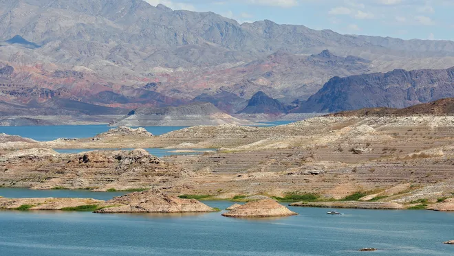
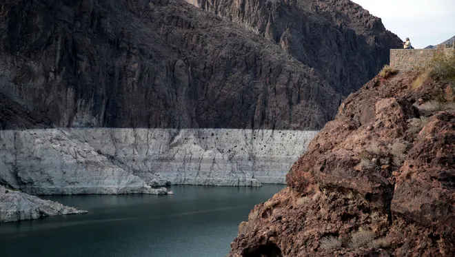
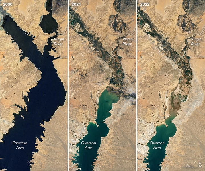
The shrinking of Lake Mead is a result of a prolonged drought in the Southwest, exacerbated by climate change and human water consumption. The lake, the largest reservoir in the US and a source of water and power for millions of people has lost 4 trillion gallons of water since 2000 and is now at 39% of its full capacity.

Since 1999, the population growth near Lake Mead has significantly reduced its water levels. This depletion, along with various other factors, has caused a decrease in the lake's water levels. Consequently, in 2020, reservoir managers had to build and activate low-level pumps to extract water during severe drought situations.

 In addition to population growth causing depletion, drought, and climate change are the primary factors contributing to the decline in water levels at Lake Mead. Over the past few years, Lake Mead and its surrounding regions have been heavily affected by drought. To illustrate, 83% of Colorado is grappling with drought conditions.

Lake Mead’s water levels have dropped so low that a white ring is visible on the surrounding mountains. Many refer to this coloration as the “bathtub ring.” The ring depicts Lake Mead’s water level had been in the past due to the water’s erosion of the bordering mountains. As a result, scientists can determine how much water Lake Mead has lost and if the decreased water levels signify a water crisis

While Lake Mead is used for drinking water and irrigation, recreational activities have also been halted due to the decreased water levels. Lake Mead had been a popular boating area for several years, but now many boating ramps are closing due to safety concerns and expense.

The water shortage at Lake Mead and the negative effects that have resulted and may result clearly indicates that humans need to conserve water and limit their use of fossil fuels and other polluting elements in the future. Halting climate change could be key to improving drought conditions and restoring the climate of the Southwest
Gallery
4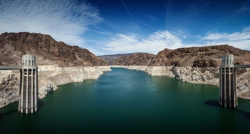
Timelines
2022
July 18
Continuing a 22-year downward trend, water levels in Lake Mead stand at their lowest since April 1937, when the reservoir was still being filled for the first time. Lake Mead was filled to just 27 percent of capacity.
June
Commissioner Touton testified before the U.S. Senate Committee on Energy and Natural Resources and called on water users across the Basin to prevent the reservoirs from falling to critically low elevations that would threaten water deliveries and power production.
2016
Lake Mead drops to a new record low of 1,074 feet, triggering the possibility of mandatory water cutbacks for Arizona, Nevada, California, and Mexico if the level stays below 1,075 feet by January 1.
2010
August
Lake Mead reached its low after decades of population growth in the American Southwest and 12 years of persistent drought. According to the U.S. National Park Service, the amount of water flowing out of and evaporating from Lake Mead has consistently exceeded the amount of incoming water in recent years.
2000
A prolonged drought begins in the Southwest, reducing the snowpack and runoff that feed the Colorado River and Lake Mead.
1936
The powerplant structures were completed, and the first generator began commercial operation in October of that year.
1928
Congress passed the Boulder Canyon Project Act, authorizing the construction of Hoover Dam and the Ail-American Canal System, which carries water to thirsty lands in California and Arizona.