The city of Sydney, Australia suffers from periodic flooding
Australia
last update:
11 months agoProblems
Reasons why sydney Suffers from periodic flooding.
By the middle of this century, flooding in areas around Sydney will occur almost every week due to anthropogenic sea level rise, according to a study by scientists from the Met Office.

The study found that if greenhouse gas emissions remain high and no action is taken to adapt to rising sea levels, then by the end of the century flooding simply caused by tides will become a daily occurrence in Sydney.

Human-induced global warming has caused sea levels to rise because as they warm, the oceans expand and take up more and more space. The melting of land-attached ice, such as ice sheets and glaciers, also raises sea levels.

According to the 2019 United Nations Climate Change and Oceans Report, global sea levels will rise faster by the end of the century, even if greenhouse gas emissions decline rapidly.

By the end of the century, sea levels will rise by 43-84 cm compared to the average level between 1986 and 2005, depending on the amount of CO2 emissions.
Gallery
3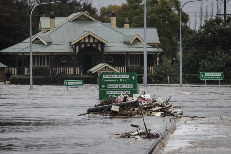
Timelines
2022
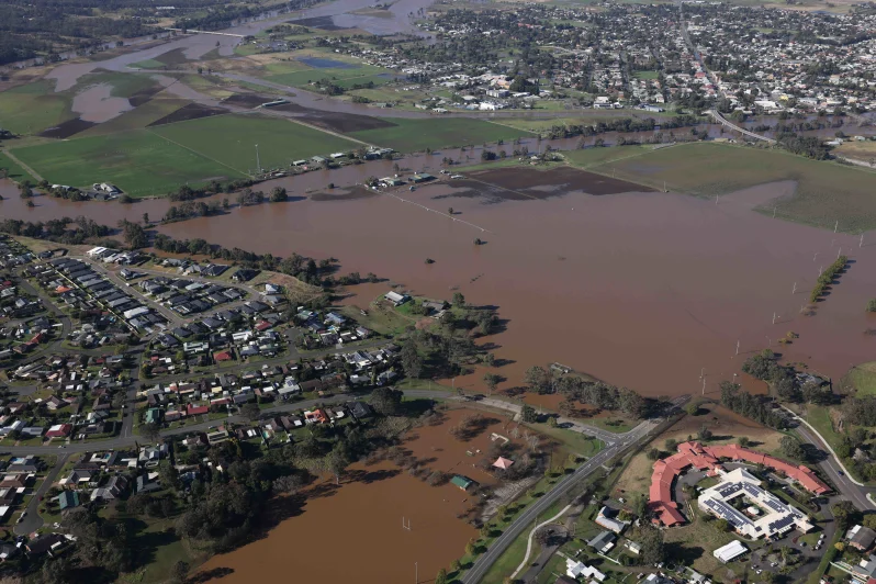
On 3 March, thousands of people in Sydney were ordered to evacuate as the Hawkesbear, Nepean and George Rivers began to rise after 100 mm (3.94 in) of rain fell overnight in parts of Western Sydney. The Warragamba Dam, Sydney's main reservoir, overflowed at a rate of over 70 gigalitres.
Playgrounds and caravan parks were flooded.
2021
On March 20, a tornado damaged homes and downed trees in Chester Hill, a western suburb of Sydney, leaving thousands without power. Heavy rain flooded the Parramatta Power Plant site, as well as the Parramatta Ferry Wharf, which was flooded after the Parramatta River burst its banks. The Warragamba Dam began to overflow, the first significant overflow of the reservoir since 1990. They were flooded, reaching a height of 10 m (32.81 ft), with Windsor Bridge flooding, flooding houses and isolating animals.
Residents of the Warragamba Dam watershed were placed on high alert on March 21 after the city's main water source reached its limit. Volunteers filled sandbags for local residents to protect their homes.
2020
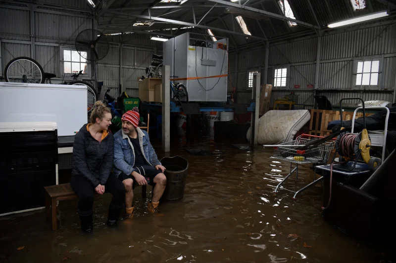
From 7 to 9 February, the Sydney metropolitan area experienced the heaviest rain in 30 years. The storm caused widespread flooding and strong winds that wreaked havoc in suburban areas and left more than 100,000 homes without power. About 391.6 mm (15.42 in) of rain fell in the city during those three days, more than three times the average rainfall for February. Thousands of people living in depressed areas such as Narrabin and southwest of Sydney near the Georges River have been ordered to evacuate due to flood waters and rising river levels.
1992
Over 300 mm (11.81 in) of rain fell in two days in the city. It was the wettest four-day period since 1990.
1990
On 3 February, the Sydney CBD received a record 24-hour rainfall of 243.6 mm (9.59 in) as Extratropical Cyclone Nancy was centered on Brisbane.

On March 18, in the Auburn and Bankstown area, large hail, up to 8 cm in diameter, with strong winds and flash floods, caused damage - windows and roofs were damaged in more than 2,000 houses.