
Problems
Causes of Water pollution in Valencia Lake, Venezuela
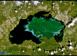
Lake Valencia is the largest natural freshwater lake of Venezuela. It is located in the central-north part of the country, which is the most densely populated.
The endorheic lake has natural discharge level at 427 m above sea level; the water level declined below this height about 250 years ago. Its surface level currently is 410 m above sea level. The lake has a number of small islands, with some inhabited.
Among the fish in the lake is the diamond tetra, which is commonly kept in aquaria, while two species of catfish, Lithogenes valencia and Pimelodella tapatapae are entirely endemic to the lake basin.
As it developed, flowing waters of river Valencia were dammed.
Intense human intervention in the catchment area and a decrease in groundwater runoff have caused a rapid decrease in the lake level.
Deforestation and water diversion for irrigation led to the desiccation of Lake Valencia by dramatically reducing water levels.
The use of the lake as water source for domestic activities and for irrigation is restricted by the high salt content.
The lake suffers from algal blooms caused by continual influx of untreated wastewater from the surrounding urban, agricultural, and industrial land uses. This contributes to ongoing eutrophication, contamination, and salinization of the lake.
Since Lake Valencia is an endorheic basin, it tends to accumulate pollutants in the water and maintain contaminated sediments at the bottom.
Polluted water has caused floods on Lake Valencia.
Collectors are siphoning only off some of those waters.
The purification process has disadvantages due to the high salinity and electrical conductivity of water.
The permanent flooding of Lake Valencia threaten hundreds of families living around who are at risk of losing their homes and even drowning in sewage.
Gallery
3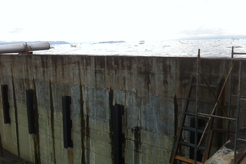
Timelines
2021
Imagery taken by one of the Copernicus Sentinel-2 satellites shows a massive algal bloom in Lake Valencia in northern Venezuela.
2005
Was built the Wall of La Punta as a temporary solution for 3 years, which has been in existence for many years. Leaks in the wall are visible.
2002
Since 1991, lake clean up scheme with finance from IDB has been described along with information on pollution loads, reuse opportunities and wastewater collection and treatment infrastructure.
1990
Since 1960, due to pollution and other human induced changes, almost 60% of the native fish species in the lake were lost.
1976
The water levels in Lake Valencia have risen due to diversion of water from neighboring drainage basins—it currently acts as a reservoir for the surrounding urban centers Maracay and Valencia.