- hot-spots
- land subsidence
- Mexico
- Land subsidence due to groundwater exploitation in Mexico
Land subsidence due to groundwater exploitation in Mexico
Mexico
last update:
2 months agoProblems
Mexico’s rapid urbanization and intensive agricultural practices have led to an increased demand for water. As a result, groundwater is being extracted at unsustainable rates, leading to a drop in water levels and pressure within the aquifers. This, in turn, causes the soil particles to compact and the land surface to subside. The problem is exacerbated by the fact that many of Mexico’s aquifers are located in tectonic valleys, where the geological conditions make the land more susceptible to subsidence.

The subsidence in Mexico was first reported in 1925, causing differential settlements in the colonial and modern structures. The area's leveling data from 1898 to 2005 shows constant land subsidence during the whole period, with a maximum subsidence of 40 cm/yr from 1998 to 2002. Recent studies used Interferometric Synthetic Aperture Radar (InSAR) and found large subsidence rates of 30 cm/yr within the city for 2007–2011, ∼35 cm/yr for 2014–2021, and ∼45 cm/year for 2019–2020. The subsidence has damaged infrastructure and disturbed water and wastewater drainage systems. For example, differential subsidence caused the left-leaning of the Metropolitan Cathedral in CDMX.

 Damage to infrastructure can lead to costly repairs and maintenance, while changes in the landscape can affect agricultural productivity. Moreover, the risk of flooding increases as the land surface lowers, making certain areas more vulnerable to water-related disasters. The people living in these regions face the challenge of adapting to these changes, often with limited resources.

Looking to the future, the problem of land subsidence in Mexico is expected to persist and potentially worsen if groundwater exploitation continues at the current rate. Predictive models suggest that by 2040, a significant portion of the country’s population could be affected by land subsidence, with millions of inhabitants living in areas at risk. Mexico must implement sustainable water management practices to mitigate the effects of land subsidence and protect its communities and ecosystems.

Land subsidence due to groundwater exploitation is a pressing issue in Mexico that requires immediate attention. Sustainable water management practices, including the reduction of groundwater extraction and the exploration of alternative water sources, are essential to address this challenge.
Gallery
4
Timelines
2026
May
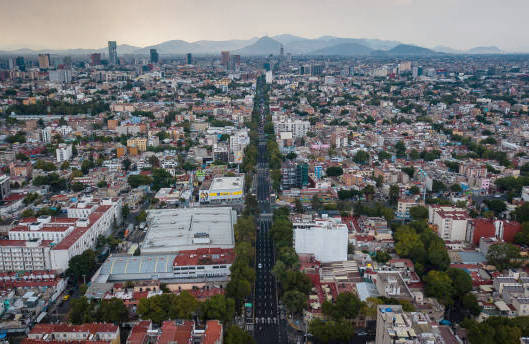
Mexico City is sinking at such an alarming rate that it’s visible from space. Imagery from a powerful NASA radar system is revealing subsidence rates of more than 0.5 inches a month — making the city one of the planet’s fastest-sinking capitals.

The city’s rapid sinking has been exacerbated by relentless urban development, with new infrastructure adding extra weight on top of the clay-rich soil.

Between October 2025 and January 2026, during Mexico City’s dry season, NISAR mapped the movement of the ground beneath the city. Its findings reveal that parts of the city are sinking at a rate of around 0.8 inches a month — that’s more than 9.5 inches every year.

Areas most affected include the Benito Juarez International Airport, the city’s primary airport.

One city landmark reveals the impacts of sinking. The 114-foot-high Angel of Independence monument, built in 1910 to commemorate the 100th anniversary of Mexico’s independence, has needed 14 steps added to its base as the ground beneath it sinks.
2021
An enhanced analysis of Mexico City’s subsidence rates and their effects was published. The study integrated InSAR, Continuous Global Positioning Systems (CGPS), and optical remote sensing data. A high correlation between geodetic methods was found, indicating the reliability of these techniques in assessing subsidence. The fastest subsidence zones were identified, correlating with areas of high and moderate building distribution density.
2018
A study using five SAR sensors revealed the long-term subsidence and potential land degradation in Mexico City. The research highlighted the continuous sinking of the city’s ground over the years. Land subsidence was linked to the excessive withdrawal of water, which led to the depletion of aquifers. The findings emphasized the need for sustainable water management to prevent further land subsidence
1992
The launch of the ERS 1 satellite allowed for the use of Interferometric Synthetic Aperture Radar (InSAR) data for geological and geomorphological analysis. This marked the beginning of using advanced geodetic methods to monitor land subsidence in Mexico City. Researchers started employing Persistent Scatterer Interferometry (PSI) techniques to observe the Earth’s surface changes. These methods would later reveal significant subsidence rates in Mexico City due to groundwater extraction.
1920
Mexico City’s subsidence was first documented in the 1920s and in the years since, residents have experienced the impacts, with fractured roads, tilted buildings and damage to the train system.