- hot-spots
- climate
- Madagascar
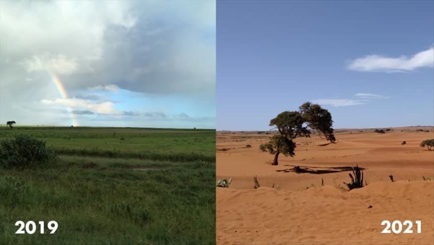
- Desertification of Madagascar
Problems
What does the environmental situation on the island of Madagascar look like?
Madagascar, a nation located on a unique island, is among the developing countries, but Madagascar ranks 178th in the 2018 ranking of the world's greenest countries, compiled annually by the Yale University Center for Environmental Policy and Law, with no positive trend

The unfavorable environmental situation in Madagascar is the result of a complex of reasons:

● slash-and-burn agriculture;
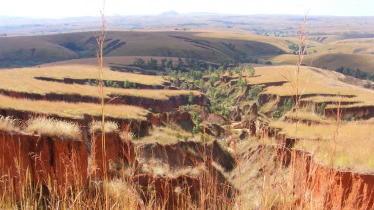
● soil erosion and degradation;
● increased waste generation, inability to handle waste properly;
● agricultural fires;
● overexploitation of living resources forced the felling of trees and destruction of animal and plant habitats to support their livelihood for lack of other ways of cooking and heating the home.

All of the above-mentioned reasons existing today on the island of Madagascar entail environmental severe problems and the unique biodiversity of many species of flora and fauna suffers the most.

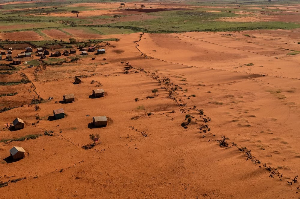
Today Madagascar is called the "big red island" - the loss of forest cover has exposed the lateritic soil of the island. This is evidenced by Global Forest Watch forest monitoring data - the island lost 510,000 hectares of tree cover in 2017 alone.
Slash-and-burn agriculture as a cause of deforestation in Madagascar
Deforestation in Madagascar is the result of several reasons. The first is slash-and-burn agriculture - the clearing of vast areas by fire to grow rice, a traditional practice imported to Madagascar by the first settlers, is still of great cultural importance today, in addition to its practical value, replacing the widespread lack of agricultural machinery.

Slash-and-burn farming is the most expedient way for many Malagasy people to provide food for their families, and where daily subsistence is at stake, it is unlikely that the long-term effects matter much to the inhabitants. After two or three such cycles, the nutrients in the soil are depleted, taking about 4-6 years to recover before the process repeats itself. New vegetation on depleted soil is scarce and weak for soil establishment, creating a new problem of erosion and landslides. Uncontrolled use of fire in cultivating land for rice crops is the leading cause of the spread of fires to adjacent wildlands. According to Global Forest Watch, an average of 3258 reported wildfires occurred between January and October 2018.

 More than 4 million hectares (9.8 million acres) are burned annually due to wildfires, exacerbated by climate change and agricultural practices.
Illegal activities of Malagasy lead to environmental degradation
The second reason is poaching and logging. The high price for selling hardwoods (mainly ebony and rosewood, which can cost around $2,000 per ton in international markets) makes illegal logging a significant problem even in the protected areas of eastern Madagascar, and on the Masoala Peninsula, because that is where most of the species-rich tropical forests remain. Here grow such valuable species as ironwood, rosewood, and many rubber-bearing trees, as well as the endemic "traveler's tree," while the drier western slopes are dominated by savannah woodlands with baobabs and palms.
Unfortunately, Madagascar has undergone environmental degradation over much of its land mass. The forests that once covered the eastern third of the island are now degraded, fragmented, and transformed into scrubland. The spiny forests in the south are rapidly giving way to "corn cactus," as native vegetation is cut up and burned to produce natural coal. Locals in southwestern Madagascar sell piles of charcoal everywhere along the roads.
How to stop the development of an ecological hotspot on Madagascar island?
It is thus possible to conclude that the successful conservation of Madagascar's wild lands requires resolving the inevitable conflicts between the short-term needs of the local population and the long-term nature of the benefits that conservation can bring permanently. Without improving the well-being of the average Malagasy, we cannot expect Madagascar's wild lands to persist as fully functional systems and continue to meet the needs of the people who live there.
Gallery
4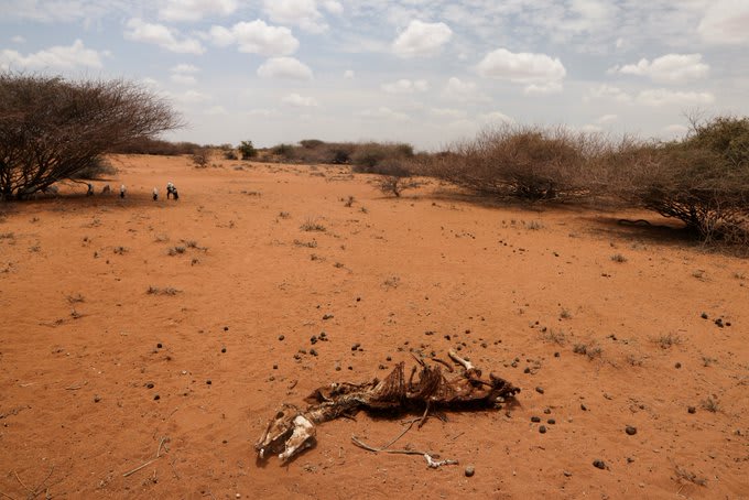
Timelines
2026
April
Crisis (IPC Phase 3) outcomes persist across much of the Grand South, remote areas of the Grand Southeast, and cyclone-affected eastern districts in Madagascar.
In cyclone‑affected eastern areas, livelihood recovery remains slow due to displacement, high shelter repair costs, and damage to rice fields and aquaculture.

Cumulative rainfall deficits of between 25 and 80 percent of the 40-year average are expected across most areas, except in the north.
Combined with erratic rainfall distribution, forecasts indicate below-average to average rainfall across most of the country. Atypically dry conditions are likely to persist through September.
March
Cumulative rainfall deficits were observed across much of southern and western Madagascar in February and March, despite average rainfall in January. This will likely result in below-average national production of staple foods such as rice, maize, and cassava during the main harvests between March and June.
2023
July 23
Conservationists in Madagascar are collaborating with local communities to combat forest fires and protect the country's endangered lemur species, which are threatened due to significant deforestation. Madagascar has lost 80% of its natural areas and is currently losing approximately 200,000 hectares annually.
Mamy Razafitsalama, Madagascar's country director for Planet Madagascar, is leading a project to safeguard 357 hectares of forest fragments and 4,000 hectares of continuous forest by raising awareness and reducing fire incidents.
Since 2018, the initiative has successfully planted over 147,000 trees to establish forest corridors. In 2023, Razafitsalama received a Whitley Award, which enabled him to clear 16 kilometers of land to create firebreaks essential for slowing the spread of forest fires in the 135,000-hectare Ankarafantsika National Park.
February 21
TC Freddy made landfall on the eastern coast of Madagascar at around 7 pm (local time). TC Freddy weakened from a category 4 cyclone into a category 3 ahead of landfall but hit Madagascar with sustained winds of 150 km/h.

In anticipation of the landfall, the Government of Madagascar put seven areas of the country into red alerts and 4 in yellow. In collaboration with Red Cross and other partners, it also evacuated thousands of vulnerable people from the coastal area, limiting the potential loss of life. As TC Freddy crossed Madagascar, it brought upon heavy rains and strong winds led to flooding and widespread damage to houses and public infrastructure.

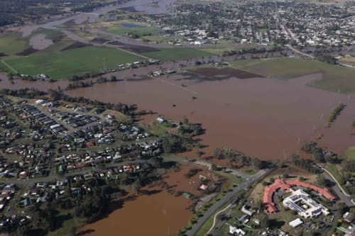
Madagascar is currently experiencing a humanitarian emergency due to Cyclone Freddy.
This caused significant damage to crops, arable land and livestock, resulting in loss of livelihoods and food insecurity.

People need help, including children who need treatment for acute malnutrition. The healthcare system was already under strain, and repeated crises only exacerbate the situation. The emergency has resulted in a dire need for food, health care, shelter, WASH and protection services.
2022
January 05
In Madagascar's Anjozorobe Angavo forest corridor, beekeepers face major challenges from rapid deforestation driven by fires, illegal logging, and agricultural practices. The protected area spans 52,000 hectares (128,000 acres) and is home to many endemic species, but it loses an average of 900 hectares (2,224 acres) of forest annually, primarily due to fire.
A beekeeping initiative, co-founded by a French-Malagasy company and a local NGO, aims to provide sustainable income for local farmers while conserving the forest. However, environmental changes threaten the project, including a fire in August that delayed the first honey harvest and reduced forage for bees. Currently, 12 villagers participate in the program, which seeks to empower communities economically and reduce their reliance on forest resources.
Sine 2018 Southern Madagascar experienced a prolonged drought as rainfall became scarcer amid a changing climate. Food security was devastated and widespread hunger ensued to reach near-famine proportions. The impoverishment and health impacts of malnutrition and stunting caused by these lean years will be felt for years to come.

Drought takes a toll on social relationships.  The strain of losing access to water, watching crops die, losing livelihoods and seeing family members go hungry can lead to social stress within households and communities, and give rise to violence and conflict. Although the economic, health and environmental impacts of drought have been widely studied, the social impacts of drought remain largely overlooked.
2021
October 22
According to the World Food Program, more than a million people in southern Madagascar are desperately trying to survive the first-ever famine caused by global climate change. The region has been hit hard by drought over the past few years.

Alice Rahmoun recently visited southern Madagascar, where the UN and its partners are assisting hundreds of thousands of locals. She saw villages there surrounded by dried-up fields and tomato beds that were "completely yellow or even brown" due to lack of moisture.

"In some areas, people can still grow something, but every year they have to overcome more and more difficulties," Rahman said. - In other areas, nothing grows now, so people survive by eating locusts, fruit, and cactus leaves. Cactus leaves used to be used only as fodder for cattle, people never ate them.
July
The Menabe Antimena protected area in Madagascar, known for its high biodiversity, is losing approximately 4% of its area annually due to deforestation and agricultural pressures, with projections indicating it could disappear by 2050. In response to increasing wildfires threatening these fragile ecosystems, USDA Forest Service specialists conducted a training course for new firefighters starting July 12th, 2021.

Eighteen participants from various organizations, including the Madagascar Ministry of Environment and Sustainable Development and Durrell Wildlife Conservation Trust, completed the course, which aimed to enhance firefighting capabilities in the region. Trainees will serve as co-trainers for future courses, expanding the network of individuals equipped to manage wildfire risks in Menabe and beyond. The USDA Forest Service International Programs office supports this initiative, and the U.S. Agency for International Development funds it.
2020
A study in Nature Climate Change has found that left unchecked, the combined effects of deforestation and human-induced climate change could eliminate Madagascar's entire eastern rainforest habitat by 2070, impacting thousands of plants, mammals, reptiles, and amphibians that are endemic to the island nation.

The researchers' data suggest that the speed and intensity of destruction to Madagascar's eastern rainforest will be greatly determined by whether the country institutes strict protections against deforestation or a relaxed set of policies. Protecting forested areas that provide shelter to ruffed lemurs and serve as corridor links to their strongholds is particularly important to survival given their role as a keystone species that enables the survival of a large number of animal and plant species in one of the world's most biodiverse regions.

The effort sprinted forward this year, completing more than 2,400 assessments by a team of Malagasy and foreign researchers.

The World Bank teamed up with researchers at the Global Studies Institute, California State University, and put in place a monitoring system to track the social impacts of the drought in Southern Madagascar. Every four months, a representative panel of 480 respondents was asked to reflect on the impacts of the drought and how various social dynamics were faring. Respondents identified the drought as causing the following particular stresses: lack of access to water and food, increased food prices, increased poverty and pressure on livelihoods.
2019
March 20
The President of the Republic of Madagascar, Andry Rajoelina, unveiled an ambitious reforestation plan at the One Planet Summit.

The island has lost 44 % of its natural forests since the 1950s and the rate of deforestation is increasing. Some 90 % of its species are endemic, and the island’s unique biodiversity is thus endangered. The challenge for the island is balancing the protection of its natural heritage with the fight against poverty. This is a huge task that calls for action on several fronts.

“Madagascar was known as the Red Island, but it will now be the Green Island thanks to our national reforestation plan”, said the President of Madagascar Andry Rajoelina.
2018
July 13
 Large areas of the Bongolava Forest Corridor in northwestern Madagascar have been illegally cleared for commercial corn farming, leading to violent protests by local farmers. On June 22, 2018, farmers from Tsiningia attacked the offices of the local nonprofit managing the protected area, Fikambanana Bongolava Maitso (FBM), destroying property and setting fire to buildings, including the homes of key staff members. This unrest followed the arrest of seven individuals for illegal land clearing, which sparked demands for their release.
The Bongolava Forest Corridor, established in 2006, spans 606 square kilometers and is home to unique ecosystems and species, but has faced significant deforestation due to agricultural expansion. In response to the violence, the Malagasy government has committed to continuing to support FBM's management of the area, outlawing corn farming within its boundaries, and considering compensation for farmers to relinquish plots in ecologically sensitive zones.
2016
February 17
Scientists from MIT and the University of Massachusetts at Amherst have found that a widespread and permanent loss of forests in Madagascar that occurred 1,000 years ago was due not to climate change or any natural disaster, but to human settlers who set fire to the forests to make way for grazing cattle.
Researchers came to this conclusion after determining the composition of two stalagmites from a cave in northwestern Madagascar.

Stalagmites are formed from water that seeps from the surface, through the soil, and enters the cave. These thin-layered pillars can persist for thousands of years, and their composition serves as a historical record of the environment above ground.
2015
December 02
In November 2015, numerous small fires were detected across Madagascar, particularly on November 11, when NASA's Suomi NPP satellite captured images showing active fires primarily on the coastal plain and along the west coast.
These fires are often linked to agricultural practices, including land-clearing and pasture management for the island's nearly 10 million cattle, with estimates suggesting that 25% to 50% of Madagascar's grasslands are burned annually. While some fires may occur naturally, many are likely human-caused, aimed at preventing the encroachment of unpalatable woody plants. Although these agricultural fires are not immediately hazardous, they can significantly impact climate, air quality, and local ecosystems if they grow out of control.
2010
December 27
Satellite data has revealed over 1,100 active fires in Madagascar's Sava region, particularly in districts like Andapa, Antalaha, Sambava, and Vohimarina, where illegal logging of rosewood and other valuable timber is rampant.
Since October 1, approximately 25% of these fires have occurred in or near forested areas, including protected sites like Masoala National Park, which has been severely affected by illegal logging. The ongoing dry conditions, exacerbated by a delayed rainy season, have contributed to longer burning periods for land-clearing fires.
Despite the high number of fires this year, it is down from the more than 1,300 fires recorded in the same period last year. Political instability following a military coup has weakened governance, reducing control over illegal logging and fire-setting activities.