- hot-spots
- forest fire
- USA
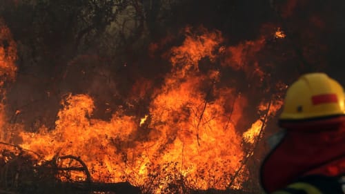
- Wildfire in Texas, USA
Problems
Texas wildfires
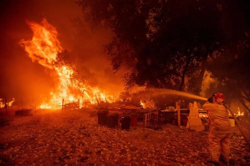
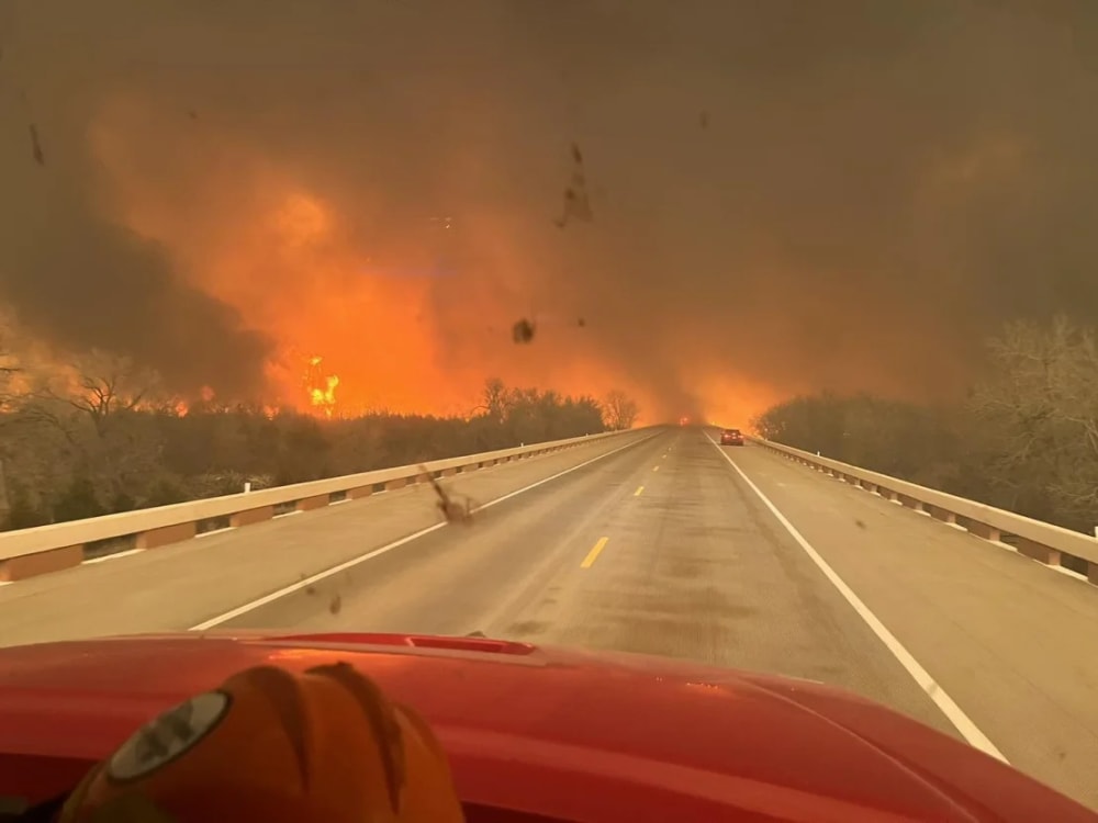
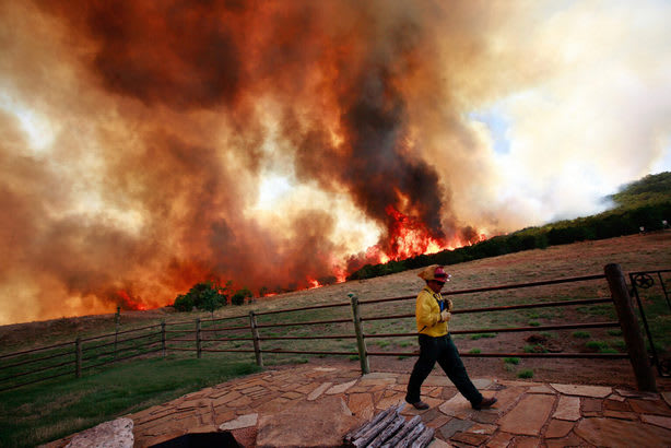
A Texas panhandle fire has consumed nearly 900,000 acres, prompting widespread evacuations, road closures and emergency declarations.

According to the Texas A&M Forest Service, the blaze is the second largest in Texas' history, since the state began recording the data in 2005.

The largest fire burning is the Smokehouse Creek Fire north of Stinnett, with only 3% containment.

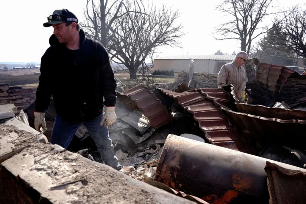
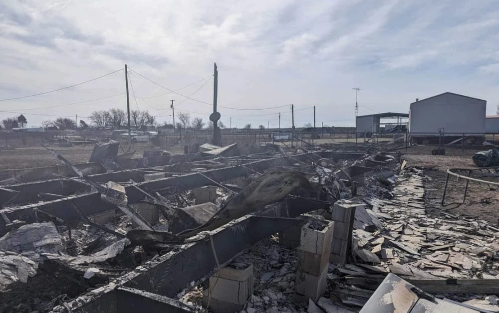
Catastrophic wildfires ripping across 2024 the Texas Panhandle have killed at least two people and threaten to destroy more homes, cattle and livelihoods as the biggest inferno in state history engulfs more land every minute.

The Smokehouse Creek fire is one of five large wildfires currently burning in the Texas Panhandle.

The Smokehouse Creek Fire has now torched more than 1 million acres in Texas alone, making it the largest fire on record in the state. The blaze had also charred more than 31,500 acres in Oklahoma, the state’s forestry service said.

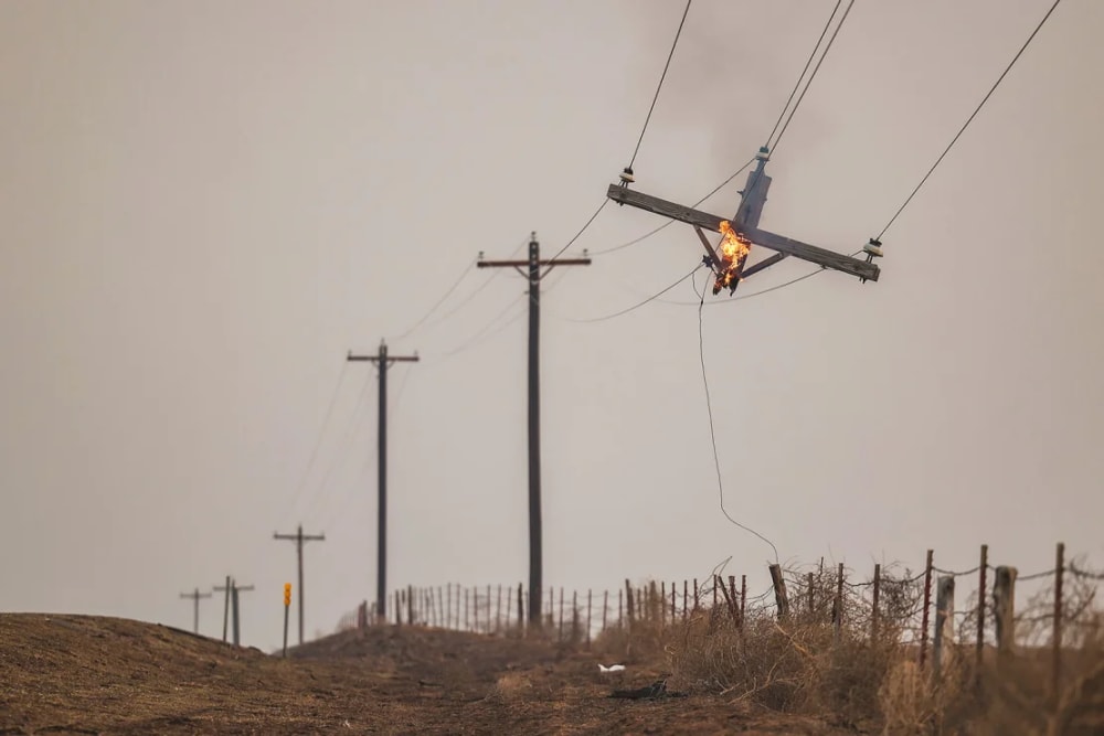
The cause of fires is still unknown but dry, warmer-than-average conditions combined with high winds caused blazes that sparked to grow exponentially, prompting evacuations across a more than 100-mile (160-kilometer) stretch of small towns and cattle ranches from Fritch east into Oklahoma.

Texas Agriculture Commissioner Sid Miller said the damage to the region could be "catastrophic."

Miller said individual ranchers could suffer devastating losses. However, he predicted the overall impact on the Texas cattle industry and consumer beef prices would be minimal.

“These fires not only threaten lives and property but will also have a significant impact on our agricultural industry,” Miller said. “More than 85% of the state’s cattle population is concentrated on ranches in the Panhandle. There are millions of head of cattle there, and in some cities, there are more cattle than people.”
Gallery
10



Timelines
2026
September 17
Burning through tall grass averaging 2.5 feet in height, the active Dry River Fire has scorched 8,761 acres in Sutton County, Texas, located 5 miles southeast of Sonora, since it started on September 15, 2.
Satellites are picking up 35 heat signatures over the last 48 hours near the 30 percent contained perimeter, reflecting the broad extent of the spread, while fire behavior is characterized as extreme, running, and creeping.
Driven by human activity on private land.

Over its two days of burning, the fast-moving front has maintained an approximate average daily growth of 4,381 acres per day. This incident unfolded during the region's typical fire season, which runs from June to October. Nationally, the broader context shows that 3,243,965 hectares have burned so far in 2026, marking a total that sits 41% below the two-decade average.
September 16
Driven by extreme wind conditions, the active Hydra Fire has raced across 1,100 acres of private brush land in Bosque County, Texas, located three miles south of Meridian. Burning for two days since its start on September 14, the incident has sustained an approximate daily growth rate of 550 acres. Satellites have registered nine heat detections over the last 48 hours, highlighting the rapid expansion of the fire front as responders battle the flames.
September 15
Dry River Fire, located 5 miles southeast of Sonora, Texas, started on September 15.
September 14
Hydra Fire, located 3 miles south of Meridian, Texas, started on September 14.
September 13
Burning across private short grass standing about one foot tall, the active Benson Fire has scorched 1,395 acres in Menard County, Texas, located 10 miles southeast of Fort McKavett. Satellites are picking up nine heat detections over the past 48 hours, highlighting the extent of the spread across the landscape.

Achieving 75 percent containment since the fire started on September 12, 2026.

This fire occurs against a broader national backdrop where 3,213,890 hectares have burned so far in 2026, marking a figure that is 41 percent below the two-decade average.
September 12
The active Benson Fire started in Menard County, Texas, on September 12.
September 09
Burning through short grass standing about a foot tall in San Saba County, the active Kurk Fire is located six miles northeast of Cherokee, Texas. Satellites have registered three heat signatures nearby over 48 hours, illustrating the spread of the incident as it exhibits active, spotting, and torching fire behavior.

The 1,000-acre blaze has been burning since it started on September 8, 2026. The incident occurred on private land under the jurisdiction of the SFS.
September 03
Burning for 10 days since its human-caused ignition on August 24, 2026, the active Ross Fire has expanded to 90,400 acres in Palo Pinto County, Texas, maintaining an approximate average daily growth of 9,040 acres per day. Satellites are picking up a low heat signature, with only 2 NASA FIRMS heat detections recorded over the last 48 hours, reflecting the current fire behavior characterized as moderate and flanking.

The fire is burning through 6-foot chaparral fuel on private land. Containment efforts have reached 38 percent for this Type 3 Incident.
August 26
As of August 26, 2026, the Ross Fire is burning across Palo Pinto and Jack counties in North Texas.
The fire has spread through areas near Graford, Worth Ranch, and the Brazos River.
This wildfire has been burning in Texas for 2 days. So far, it has affected roughly 80,000 acres - about 324 km². Crews have contained 12% of the perimeter, but most of the fire line is still open.

Strong northwest winds have pushed the fire south and compromised part of the containment line, averaging an explosive 40,000 acres per day since it ignited on August 24, 2026.
Satellites are picking up 321 heat detections near the perimeter over the past 48 hours, illustrating the broad scale of the spread across private land managed by the SFS.

The fire is worsening air quality over Dallas-Fort Worth, and the Texas Commission on Environmental Quality issued an air quality alert Wednesday for North Texas. Air quality could be unhealthy for some sensitive groups, which include children and older people, those with asthma and other lung diseases, and people active outdoors for more than six hours a day.
August 24
The Ross Fire began in Palo Pinto County on the afternoon of August 24 and quickly grew, scorching more than 50,000 acres and destroying multiple structures.

The Ross fire began as a grass fire near Highway 180 and R D Bell Road, approximately 3 miles southwest of Palo Pinto. Authorities have not determined what sparked the fire.
May
A wind-whipped wildfire in the Texas Panhandle, one of multiple major blazes to hit the region this month, has destroyed more than 50 homes, authorities said.

The blaze is among five major wildfires that have hit the Texas panhandle since May 14. The largest fire was the Hunggate Fire in Randall County that burned 34,124 acres and destroyed several homes before it was fully contained, officials said.
March
The “Yellow Fire”, which occurred in northwestern Texas in early March 2026, marked one of the first major wildfires of the year in the United States. During the response effort, local authorities issued evacuation orders for several areas and closed numerous roads to ensure public safety and support containment operations.

The fire affected more than 5,000 hectares on 15 March 2026.
Copernicus satellite data support wildfire monitoring, providing reliable information for emergency response, land management, and risk mitigation planning.
2025
March 15
As of 6:30 p.m. CST, 10 wildfires remained uncontained throughout north, east, central and south Texas, according to the Texas A&M Forest Service Incident Viewer.

The Crabapple Fire, the wildfire near Fredericksburg in Gillespie County, has burned 8,640 acres and is 0% contained, as of 6:30 p.m. CST according to the Texas A&M Forest Service Incident Viewer.

The fire with the largest footprint is the Windmill Fire in Roberts County, which is about 83 miles northeast of Amarillo, Texas. The fire had raged through more than 23,000 acres and was 65% contained, as of 6:30 p.m. CST according to the Texas A&M Forest Service Incident Viewer.

To contain the Windmill Fire, a Texas A&M Forest Service Large Airtanker dropped bright red retardant over Roberts County afternoon.

The Texas A&M Forest Service responded to 11 new wildfires that burned 9,115 acres, spanning from the Texas Panhandle to South Texas.
March 14
An outbreak of wildfires began in Texas as winds exceeded 30 miles per hour and dry land provided the ideal fuel.
2024
February 29
The inferno is one of three fires burning in the Texas Panhandle – with no end in sight. Despite light precipitation in the area Thursday, dry air and ferocious winds are expected to return Friday and into the weekend – likely fueling the flames.

Joe Biden, who was in Texas on Thursday to visit the U.S.-Mexico border, said he had directed federal officials to do "everything possible" to help fire-ravaged communities, including sending firefighters and equipment. The Federal Emergency Management Agency has guaranteed that Texas and Oklahoma will be reimbursed for emergency expenses, the president said.
February 27
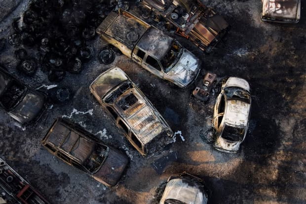
The advancing flames caused the main site dismantling America's nuclear arsenal to pause operations Tuesday night, but it was reopened for normal operations by Wednesday. In the small town of Fritsch, which lost hundreds of homes to fire in 2014, another 40 to 50 homes were destroyed this week, Mayor Tom Ray said.
2021
Wildfire risk is generally expected to increase across the state as climate change progresses because the landscape will be drier and there will be more vegetation to burn, according to Texas State Climatologist John Nielsen-Gammon's 2021 report on extreme weather.

Those effects will still vary regionally, according to Nielsen-Gammon's findings. In the next two decades, the chance for wildfires may increase more slowly in the Panhandle and Far West Texas because there will be less plant matter to burn. But more areas of the state to the east may begin to suffer from wildfires as the plants there dry up in the heat.

Nielsen-Gammon said that fire-prone communities need to be prepared no matter how much their risk increases.
2017
An outbreak across the Great Plains burned 480,000 acres in the Texas Panhandle and killed five people, including two young cowboys and a nurse who managed to save a ranch’s cattle but lost their own lives in the process. Many other ranches in the area lost either their livestock or the grass they depended on.
2015
Bastrop Country suffered from a large wildfire.
2014
The town’s Fritch, Texas northern edge was hit by a devastating wildfire.
The town lost hundreds of homes in a fire.
2011
Before the Eastland fires, the disastrous 2011 fires in Bastrop County near Austin killed two people, destroyed more than 1,600 homes, and caused an estimated $325 million in insured property damages, according to the Insurance Council of Texas. The Bastrop fires burned through much of the Lost Pines, a unique ecosystem of loblolly pine trees that has adapted to a dry climate and grown farther west than any other loblollies in the country.
2006
The largest fire in the state's recorded history was the East Amarillo Complex Fire in 2006, which burned about 1,400 square miles (3,600 square kilometers) and killed 13 people.
1980
Began reliable record-keeping fires in the 1980s.